GeoNeurale
 
The Society for the Geosciences applications of Geostatistics and Neural Networks  
  
Raster


GeoNeurale  RESEARCH AND INNOVATION

Many years ago we identified Artificial Intelligence as a revolutionary innovation
for its potential application in the geophysical sciences and we follow its
evolution since the beginning of this millenium.
Our scientists hold multiple specializations and certifications in Deep Learning
and Machine Learning in the robotic industry.
In 2019 GeoNeurale-Wavefields grounds the "Neural-Geophysics Lab" in Augsburg.
By the integration of Geophysics, Spatial Statistics and Artificial Intelligence our
Lab developed new algorithms for applications in 3D Seismic Processing, Inversion

and Petrophysical integration.
Based on these experiences the Neural-Geophysics Lab started a new series of
training courses for the oil exploration industry and companies which are interested

in Artificial Intelligence applications.

 -->  The Neural-Geophysics Lab - Augsburg


______________________________________________________________________________________


The Neural-Geophysics Lab

Latest results from our Research Lab:

DYNAMICS OF CATEGORICAL LATENT SPACE IN CONVOLUTIONAL NEURAL NETWORKS

AND THEIR APPLICATIONS IN THE SEISMIC ATTRIBUTES ANALYSIS

GeoNeurale research paper, presented at the Machine-Learning workshop of the "Society of Exploration Geophysicists"  2022

SEISMIC ATTRIBUTES PROCESSING IN NEURAL-NETWORKS LATENT SPACE

DEEP LEARNING AND SPATIAL STATISTICS : INTEGRATED APPLICATIONS

GEO-MACROSYSTEMS AND MICROSYSTEMS THEORY : the link between Elastic and Electrical Parameters

__________________________________________________________________


GeoNeurale: LIST OF OUR CLIENT COMPANIES


ACTUAL THEMES AND APPLICATIONS

GeoNeurale welcomes feedback from the scientific community

AFTER THE PANDEMIC PERIOD

GeoNeurale resumes its Newsletter distribution with new impulses for the geophysical and artificial intelligence research, new motivation and new
committment


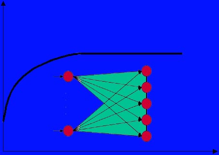
* In the January 2023 News: a new article from

GeoNeurale Research.

Dynamics of latent space information in convolutional neural networks and their applications in the seismic attributes research

For the first time GeoNeurale – “Neural-Geophysics Lab” relates interneural activity to seismic attributes introducing a new chapter in the exploration seismic research

Imagine that you can measure the impulses at the interface between two
neurons in the human brain and detect which is their correlation between the images you can see with your eyes or the music you can hear with your ears, how the impulses can be stored into memory and how can we subsequently pronounce the words: “Mona Lisa of Leonardo da Vinci” or “Adagio from Symphony N. 2 of Sergei Rachmaninoff”.
How can we classify the impulses that our brain detected ?
Certainly the brain mechanism is extremely complicated and mysterious for us, much more than a neural network.

If the animal brain is so complicated however we can already extrapolate useful algorithms from what we consider its very elementary models.
Convolutional neural networks or recurrent neural networks.

In deep-learning convolutional neural networks can already be used to extract a lot of informations in the interneurons data flow which translates images into categorical data.

GOAL OF THE RESEARCH

Our research lab studied the possible informations deriving from the dynamics of the internal activations in convolutional neural networks to classify 3D seismic amplitude maps in terms of structural attributes.
We can manipulate the characteristics of the Softmax or exchange the categorical output constraining the backpropagation parameters with feature data of other attributes like images or RNN wave data.
Then the backpropagation will be consequently influenced.

Consider for instance the results of linear algorithms in attributes analysis for pattern recognition and texture mapping like: Energy, Entropy, Homogeneity (K. Marfurt, S. Chopra).
These were based on the statistical properties calculated from the co-occurrence matrix.
Similar attributes for pattern and structural recognition were extracted from the statistical analysis of interneural activations at different deeper level layers information of very deep convolutional neural networks.
These networks are also capable of producing outputs of amplitude maps with enhanced edges resolution.

DOWNLOAD THE FULL ARTICLE


* In the May 2018 News: a new article from

GeoNeurale Research.

MACHINE LEARNING ALGORITHMS APPLICATIONS IN SEISMIC AND PETROPHYSICAL ANALYSIS
Part 2 : NON-LINEAR HYPOTHESES IN SEISMIC AND PETROPHYSICAL SYSTEMS

Unless we have formations with homogeneous and isotropic textures and mineral systems and same spatial properties for geological architectures we will encounter non-linear relations between input and target attributes. This is the normal situation in all seismic and petrophysical problems. This issue could trigger a discussion on geostatistical methods in which local properties can always be abstracted from the macrosystem and assume a linear simulation behavior. Non-linear systems in geophysics are used for classification and mapping. We can have binary and multiclass classification (where multiclass classification can also be fed into an output database for discrete parametric quantification).
Logistic operators build up basic units that can be extended into neural
systems which can learn most complex non-linear hypotheses.
In critical problems encountered in geophysics it is important to fill
database of interpretation parameters where measurements are not available.
For instance the calculation of a target log from other input logs, the
calculation and spatial distribution of petrophysical properties in the
seismic attributes volume. Classification is extremely important for
reservoir characterization. Binary classification can predict a formation
based on an input of petrophysical, seismic attributes with eventual
addition of geological and structural constraints.
Multiclass classification can discriminate between target formations or
attributes based on inputs of measured parameters and calculated
petrophysical and seismic attributes. Classification is a probabilistic
quantification that an event will be verified. The convention is that
an output will be positive when equal to 1 , or negative when equal to 0.
For theses issues the transition from linear into non-linear regression
is a main step for further development of algorithms to compute complex
features and learn the behavior of a geological system.
Originally classification problems were solved by linear regression,
for instance distributing a sample dataset of a single feature and
computing the linear hypothesis which minimizes the cost function,
obtaining the slope of the regression line. Then choosing the point
y= 0.5 as discriminating point between 0 and 1. As a very simplified
example we could think x = Shy/Sw and y = Prob (Pay) for oil
exploration or for deep geothermal reservoirs x = Flow Rate and
y = Prob (5 MWatt) (Fig. 1).
DOWNLOAD THE FULL ARTICLE


* In the April 2018 News: a new article from

GeoNeurale Research.

MACHINE LEARNING ALGORITHMS APPLICATIONS IN SEISMIC AND PETROPHYSICAL ANALYSIS
Part 1 - LINEAR HYPOTHESES


Applications of machine learning algorithms are increasingly used in seismic and petrophysical interpretation both for analog prediction and for classification.
In “supervised mode”, a training set of input variables (parametrized by some features) and target values is used to model / train a hypothesis function useful to predict future target values. Each time that we are confronted with an optimization problem we have to go through 3 main phases:
1. Definition of a hypothesis function for the best approximation of the training set .
2. Calculation of a cost/objective function (error between the regression approximation and the training set) as difference between each element of the training set ordinate and the corresponding hypothesis ordinate (at same abscissa of the considered element). This corresponds to half of the sum of square errors normalized for the number of samples in
the training set.
3. Calculation of the gradient descent of the objective function to define the parameters that will minimize this function.
If the hypothesis of a linear regression is optimized to forecast an unknowns which belong to the class of the training set with maximum probability we still can have problems in forecasting events which are not strictly linear. In this case higher order polynomials have to be used to better approximate the optimal hypothesis. However linear regression is well used in many problems that describe clear linear relationships between parameters. This could refer to many examples like Archie properties forecast in clean sands or pure intercrystalline porosity in
carbonate for petrophysics and seismic inversion for flat simple tectonic and stable elastic formation properties.
One log can be predicted from three or more different logs through linear or non-linear regression.
With multiattributes analysis we can forecast the distribution of petrophysical properties in the seismic volume through seismic attributes.
In new applications like PreSDM, tomographic inversion, FWI and velocity analysis (SO-CIG), multivariate regression is often used to flatten the CIG or minimize the difference between the model and other seismic or petrophysical constraints.

DOWNLOAD THE FULL ARTICLE


* In the March 2018 News: GeoNeurale presents the new

SEG DISC course of Kurt Marfurt in Munich.

" SEISMIC ATTRIBUTES AS THE FRAMEWORK FOR DATA INTEGRATION THROUGHOUT THE OILFIELD LIFE CYCLE "

While lower in vertical resolution than well log and core data, 3D seismic data provide a more comprehensive image above, below, and at the reservoir than any other data source. For this reason, 3D seismic data and its derivative products form the natural framework for subsequent data integration for both static and dynamic earth models. In the exploration part of the oilfield life cycle, seismic data and seismic attributes image horizons and delineate faults. While interpretation
in the exploration stage is necessarily qualitative, it is based on scientific principals of stratigraphy and structural geology.
Attributes illuminate architectural elements that help determine the depositional environment, while small faults and flexures help determine the deformation process.
In the development part of the oilfield life cycle, the addition of downhole measurements provides a means to become more quantititative. Correlation of image logs and microseismic events with curvature and azimuthal anisotropy help define areas that are more intensely
fractured. Well log measures of P-velocity, S-velocity, and density coupled with rock physics data bases and systematics provide the basis for seismic impedance inversion, allowing the interpreter not only to evaluate direct hydrocarbon indicators but also to construct a
geocellular model.

DOWNLOAD THE COURSE PRESENTATION

* In the February 2018 News: a new article from

GeoNeurale Research.

" DETERMINISTIC CONSTRAINTS IN SEISMIC INVERSION, STATIC MODELING AND FWI "

In seismic inversion, FWI and static modeling there are two main
problems. Filling the 3D volume with parameters where measurements
are not available and screening higher resolution where measurements
do not allow higher resolutions. An additional problem is the
positioning of the property values within the volume assuming that
the difficult process of a proper velocity modeling and migration
( construction of the reflector structure, assignment of each
reflection event to the proper bin ) have been successfully
implemented.
Regions of the subsurface where the joint variographic / spatial-
covariance function for seismic impedance or attributes parameters
lays within stable tolerance limits (meaning relative constant
values) can be called “Uniform Regions for seismic impedance or for
a specific attribute”. This will usually mark a specific lithological
formation or subdivision within the same formation into different
fluid/gas saturation, texture or mineral compartments.
In the seismic impedance domain the joint variographic parameters
would be velocity and density which would constrain themselves and
their product within the limits typical for the formation or compartment
under consideration.
Outside uniform regions, the general variability trend from a region to
the next offer further instruments of discriminating trends ( isotropy
and anisotropy ).
A variogram model can be calculated on 360° or solid angle directions,
which will produce different variograms for every directions.
After determination of Sill, Range, Nugget Effect for each variogram, the spatial data can be screened for  homogeneous, heterogeneous, isotropic or anisotropic behaviour.
If the values of Sill, Range, Nugget Effect are constant in all directions,
then we will have full isotropic behaviour otherwise, anisotropic behavior and the significance of each specific parameter defining the variogram geometry will have to be studied in the context of interscale and regional  variability.

DOWNLOAD THE FULL ARTICLE

* In the January 2018 News: a new article from

GeoNeurale Research.

" DIFFRACTIONS, REFLECTIONS, Vp , Vs - Part1 "

Quality control on common offset gathers domain has always been an
important phase of the seismic processing workflow. Since many
years regarded as a method of continuous reflector exploration and
imaging, the concept related to common image gathers (CIG) can be
illustrated in the 3D prestack volume for 2D seismic data and 4D
prestack volume for 3D seismic data or even 5D when azimuthal
shot-receiver directions are taken into consideration for reservoir
anisotropy studies and increasing fold and S/N ratio. Sorting this
data volume is used in the Prestack time migration and Prestack
depth migration with tomographic velocity model building although
a strictly physical approach and efficient variant for migration
algorithms could be a sorting volume in the common scattering angle
domain. The goal is to follow reflector imaging continuity in terms
of semblance and amplitude attributes (track the image of the
reflector point). Then CMP and AVO data sorting itself can be then
implemented as a subdomain of these volumes.

DOWNLOAD THE FULL ARTICLE

* In the March 2017 News: a new article from

GeoNeurale Research.

" TOMOGRAPHIC INVERSION IN THE PreSDM AND PETROPHYSICAL CONSTRAINTS "

(Prestack Depth Migration and velocity model analysis -
constraints beyond the seismic resolution.)

A velocity (V) model is one the most important steps on the
seismic processing workflow and a first fundamental phase of
seismic imaging.

The refinement of the V model follows in upgraded steps
after residual statics corrections, repeated NMO correction,
usual application of up to the 4th order moveout term as a
function of Thomsen parameters in consideration of local and
azimuthal anisotropy.

In the Prestack depth and WE Migration wide use is made of
an objective (cost) functions that QC the refinement and
convergence of the model to minimize the error through minimum
admissible levels. A similar concept can be applied to FWI
problems.
In the specific case a PreSDM is performed in the common offset
domain with the construction of common image gathers.
A model for an objective function is here presented which
integrates rock physics and petrophysical constraint to the
macro seismic velocity model, thus relating geomacrosystems
and microsystem in a unique model relating migration and
formation evaluation concepts as input in the V model.

In general the objective function C(m) is made up of at least
3 terms. An auto-adjusting term which adjusts residual moveout
(DeltaZ) after new update of V perturbation and anisotropy, a
hard constraint term relating seismic reflectors to sonic logs
(ties) and a soft constraint term reflecting the geostructural
model. Here two terms are introduced, a rock seismic model
and a petrophysical constraints term which are interacting
upon velocity perturbation parallel with the Jacobian matrix
gradient updating the residual moveout.

DOWNLOAD THE FULL ARTICLE


* In the April 2016 News: a new article of Gene Ballay

"QuickLook"

In today’s environment, the hand calculator on our desk has more computational power than did the computer that first sent man to the moon. We benefit in many ways from this power, but it behooves us to remember “the basics”.
Quick Look interpretations serve many functions. Legacy files will often include QL results, which should be well understood before moving forward. Not only do the QL interpretations provide a rapid first-look at a well, but they also serve as a benchmark against modern computerized results. When the basic porosity logs are displayed appropriately, Phi(QL) is estimated by simply drawing a line “down the middle” and Rw follows from a ratio of the resistivities. These calculations may be invoked even as depth shifting / splicing is done, so that just as soon as the digital database is complete, we are also ready to characterize (first pass) the porosity, Rw(Resistivity Ratio) and Sw(Resistivity Ratio).
Later (final) calculations will typically be more sophisticated, but even then the QL estimates will provide a valuable benchmark. For example, we have personally observed, repeatedly, probabilistic results that predicted hydrocarbons across an interval for which the QL was “wet”: the QL was correct. Not to demean probabilistic models at all, but those calculations can be very dependent upon initialization parameters.
Quick Look algorithms do not replace modern tools and techniques, but rather supplement them. Understanding Buckles, Morris & Biggs and the many other Yesterday’s Hero provide the baseline upon which we can better interpret today’s high technology options.

DOWNLOAD THE FULL ARTICLE

* In the February 2016 News: a new article of Pedro Romero

"NMR Rock Typing"

NMR T2 distribution has been related to pore geometry.
In this work we present an approach for rock quality determination using NMR measurements on core plug samples.
We measured the NMR T2 relaxation in the laboratory for several core plug samples from clastic reservoirs in Eastern Venezuela. In addition, a standard petrofacies classification for the whole sample set was performed based on the main pore throat radius for 40% of mercury
saturation also called r35.
After analyzing the NMR results of samples of each petrofacies we found characteristic patterns in their T2 distribution curves. A detailed study reveals that the new classification can be defined on the basis of the ratio of free fluid index (FFI) over bound fluid volume (BFV), already explicit in the Timur-Coates permeability equation.

DOWNLOAD THE FULL ARTICLE


* In the October 2015 News: GeoNeurale in discussion with Robert Garotta

"WEAK POLAR ANISOTROPY" ISSUES: THE VOLUME OF INVESTIGATION

Many seismic anisotropy and rock physics studies are related to laboratory tests solving for various anisotropy models (VTI, HTI, Orthorhombic , Triclinic etc.). Theoretical Models are upscaled at the seismic resolution scale. Rock physics models have also been developed (Sequential Effective Medium Modelling) which are appear to be most representative of the formation in place. From these assumptions a first observation a geoscientist would probably afford is: "which is the volume of investigation for anisotropy models in the contest of 3D seismic measurements" ? We solve also this issue considering several anisotropy models but certainly starting from weak polar anisotropy. As far as the propagation is isotropic, two parameters only (λ, μ) are present in the non-zero Cij values of the Chirstoffel’s matrix, most of them are zero. Anisotropy means non-zero values of the ε,δ,ϒ Thomsen’s parameters, moreover privileged orientations may exist. Since ε,δ,ϒ are linked to Cij constants, previously non-zero values become more complex, other ones are no longer zero.

DOWNLOAD THE FULL ARTICLE

* In the July 2015 News an article of Robert Garotta

FULL SEISMIC INVESTIGATION MEANS MULTI-COMPONENT SEISMIC

The early seismic users aimed at time sections evocating geological
structures, however the present user’s ambitions are 3D blocks (X,Y,Z)
displaying color coded values of the elastic parameters (VP, VS, ρ)
and additional seismic attributes parameters related to rock physics,
anisotropy, reservoir architecture.
This is the context of one-component P mode seismic, where only one component of the emerging wavefield is recorded. In the one-component or P mode however we are faced with several problems like:
- seismic noise cancellation
- time to depth conversion
- elastic inversion.

In addition to the P mode wavefield, multi-component seismic records reflectivities issued from other wavefields that include shear wave travel path. PSV mode whose PS conversion occurs at the reflection point is the most convenient one since it includes an upgoing shear
mode travel path.

DOWNLOAD THE FULL ARTICLE

* In the March 2015 News an article of Pedro Romero

MIXTURE OF GAUSSIAN FITTING OF NMR SPECTRA FOR RETRIEVING FLUID DISTRIBUTIONS

The de-convolution of low field NMR spectra, especially those obtained from borehole logging tools, is a very important procedure that can unveil information hidden in the T1, T2 or Diffusion. This information is associated with the determination of the spectral components present in the distributions that can be used to identify reservoir rock quality and fluid types. The fitting method presented in this paper uses as input only spectral data already available after inverting the NMR echo trains; it identifies the bins where the spectral components are located and quantifies them in terms of height, mean and variance corresponding to the selected fitting curves.

DOWNLOAD THE FULL PAPER

* In the February 2015 News an article of Pedro Romero

NMR FLUID TYPING

This article is about the principles of NMR fluid typing referring to 1D- and 2D-NMR Laplace Invers Transform of the magnetization decay.

NMR logs can provide useful information about the fluids located within the invaded zone of the near-wellbore volume, normally between one and five inches depth of investigation. The range of fluids that can be detected by NMR logs depends on the fact that the magnetization decay is sampled at the inter-echo time (TE) using magnetic field gradients (G’s).

DOWNLOAD THE FULL ARTICLE

* In the October 2014 News an article of Pedro Romero
Determination of porosity, bound and movable fluids, pore size distribution, fluid identification, oil viscosity, permeability and capillary pressure are essential petrophysical parameters for reservoir characterization and formation evaluation. Among logging technologies, low field NMR technology has a proven record of successful applications delivering these key parameters, not only at laboratory scale but also as well logging service, both wireline and LWD.
The very raw NMR signal is called Echo Train, which describes the loss of magnetization of the Hydrogen protons. It is typically described as a multi-exponential decay that is transformed after a Laplace Inversion into a distribution of relaxation times -the T1 or T2 spectra.
T1 characterizes the longitudinal and T2 the transversal relaxation.

DOWNLOAD THE FULL ARTICLE

* In the September 2014 News an article of Gene Ballay
In today’s busy office environment, it is all too easy to become focused on the end product (and the associated delivery deadline), at the expense of basic data quality and interpretation algorithm issues: we are, in a sense, working with our Eyes Wide Shut. As one of many possible examples, it is common to associate an increase in GR with
an increase in clay content, indicative of the need to perform a clay correction to both porosity and Sw.

DOWNLOAD THE FULL ARTICLE

* In the June 2014 News a GeoNeurale-Research article

3D Multicomponent Seismic: Joint Inversion in the Seismic-Petrophysical Integration context

ThIn the specific case of well logging, the stressfield change has a major impact on changing the P and S waves velocities (and

polarization) on the sonic measurements. The stressfield undergoes a new reassessment into the cylindrical geometry of the wellbore. Each case has to be studied in function of inclination and azimuth i.e. orientation angle towards main overburden maximum stress (Sigma1), secondary stress (Sigma2) and minimum stress (Sigma3).
Expecially S waves are higly effected as the stressfield can split and polarize the energy in fast and slow polarized S waves.
Another critical factor at the sonic frequencies is the different interaction between wave propagation and heterogeneity. Rigidity is highly affected by corresponding heterogeneity scale relative to wavelength. At increasing grades of heterogeneity, dispersion can be an issue.

In seismic inversion we consider the sonic and VSP measurements for calculation of Seismic Impedance, but in the Multicomponent Seismic Inversion the derivation of S wave velocity is a critical problem.

DOWNLOAD THE FULL ARTICLE

* In the March 2014 News a GeoNeurale-Research article

Vertical Transverse Isotropy and AVO Rs Reflectivity

The original formulation of the stress distribution on an elementary
cube as a 3x3x3x3 tensor has allowed originally to calculate the
directional dependence of P and S waves velocity in anisotropic media.
In a equilibrium situation the 9 stress components are reduced to 6.

DOWNLOAD THE FULL ARTICLE

* In the January 2014 News a GeoNeurale-Research article

Discussion on 3D3C Seismic Multicomponent

Multicomponent seismic concerns the acquisition of P and S waves
( compressional (P) and shear (S) wave modes ).
This adds new inputs in a system of equations aiming to solve for
dynamic elastic attributes. As far as wave velocities is concerned,
P-waves are dependent on three bulk rock properties (compressibility

K, rigidity and density) while S-waves are only influenced by two of them: rigidity and density.

DOWNLOAD THE FULL ARTICLE

* In the October 2013 News a Paper presented from Robert Garotta.

Wave Polarization in Anisotropic Media

Seismic exploration consists in acquiring, then analyzing “particle motion” triggered by a seismic source. Except in a 1D space, a motion is defined by its amplitude and orientation. For a number of decades, being able to detect spatially consistent particle motions was seen as, and indeed was, an effective exploration tool. AVA analysis gradually widened the field of seismic exploration, and this is probably a reason why motion orientation is most often ignored.Of course, neglecting orientation, assuming the vertical emergence of seismic waves, can be seen as a reasonable approximation as long as only P-mode propagation is considered and as long as approximate high degree AVA terms are accepted.

DOWNLOAD THE FULL PAPER

* In the April 2013 News a Paper presented from Björn Paulsson.

Björn N.P. Paulsson, Julio L. Toko, Jon A. Thornburg, Frank Slopko,
Ruiqing He, Chang-hua Zhang

A High Performance Fiber Optic Seismic Sensor System

We are introducing a new fiber optic sensor system implemented
as a Fiber Optic Seismic Sensor (FOSS)™ for geophysical imaging
and monitoring. We are presenting the design and experimental
test results for the fiber optic sensor and comparing its performance with regular exploration geophones and high performance
accelerometers. We demonstrate that the new Fiber Optic Seismic Sensor (FOSS)™ has a significantly better performance than the current state-of-the art coil geophones and accelerometers in terms of noise floor, sensitivity, frequency response and high temperature performance. We are also presenting the deployment system that makes it possible to deploy 1,000 (one thousand) downhole 3C seismic sensors in both vertical and horizontal boreholes.

DOWNLOAD THE FULL PAPER

* In the October 2012 News a Paper presented from Renate Pechnig.
M. Linek, M. Jungmann, T. Berlage,R. Pechnig, C. Clauser

Rock classification based on resistivity
patterns in electrical borehole wall images

IElectrical borehole wall images represent grey-level-coded micro-resistivity measurements at the borehole wall. Different scientific methods have been implemented to transform image data into quantitative log curves. We introduce a pattern recognition technique
applying texture analysis, which uses second-order statistics based on studying the occurrence of pixel pairs. We calculate so-called Haralick texture features such as contrast, energy, entropy and homogeneity. The supervised classification method is used for assigning characteristic texture features to different rock classes and assessing the discriminative power of these image features.
DOWNLOAD THE FULL PAPER

* In the September 2012 News a Presentation of the company OPPtimal

OPPtimal Reserves Evaluation

In addition to providing general Exploration & Development consulting services, OPPtimal is specialized in seismic reservoir characterization. OPPtimal utilizes the very latest seismic volume interpretation methods, and has developed its own innovative & proprietary techniques and workflows for the visualization of fracture networks from seismic data at extremely high resolution.
DOWNLOAD THE PRESENTATION


* In the August 2012 News an Article of

Song Hou

HS-Joint Full Waveform Inversion of surface, VSP and crosswell seismic data - a 2D acoustic case study revised

Full waveform inversion (FWI) is a challenging data-fitting technique,
based on full wavefield propagation and a nonlinear inversion algorithm,
to obtain an accurate model of underground media.
With the advance of high performance computing and multi-component wide-aperture and wideazimuth acquisitions, full waveform inversion has become increasingly powerful for extracting reliable subsurface information.

DOWNLOAD THE FULL ARTICLE


* In the July 2012 News an Article of

Gene Ballay and Nelson Suarez

Archie´s "n" Exponent: the rest of the story

Conceptually the Cementation Exponent represents the “efficiency” of a brine saturated pore system to conduct electricity relative to the conductivity of the brine itself. The Saturation Exponent describes the “efficiency” of a partially brine saturated pore system to conduct electricity in the presence of a non-conductive hydrocarbon phase,
relative to the fully brine saturated baseline.We then mentally realize that “n” will be related to wettability. Should the rock take on an oil-wet character, the conductive brine phase will begin to be “choked off”
somewhat analogous to the cemented bead pack effects on “m”, investigated by Wyllie and Gregory. What may be less immediately obvious is the role that the basic pore system can play in “n”. In many cases, the essence of carbonate petrophysics relative to clastic petrophysics is that of pore system heterogeneity versus clay conductivity. And should there be a multi-mode pore system, there may well be an effect on both “m” and “n”. In the case of a single-mode pore system, we often find a linear relation (on a Log-Log display) between the Resistivity Index [R(Sw<100%)/R(Sw=100%)] and Sw, with a slope that is related to Archie’s exponent “n”.

DOWNLOAD THE FULL ARTICLE


* In the June 2012 News an Article of

Ralf Oppermann

A revolution in seismic visualisation of fault networks - implications for the drilling and production of resources.

Fault and fracture networks can have significant effects on drilling,
mining and the safety of resource operations, and can also significantly
impact reserve recovery & productivity. Due to this, various automatic
fault extraction techniques have been developed for structural volume
interpretation purposes in recent years.
This paper presents innovative techniques and workflows that have been developed by the author to integrate high-resolution 3D seismic fault extraction results with the detailed calibration and review of various seismic and well data.

DOWNLOAD THE FULL ARTICLE

* In the May 2012 News an Article of

R. Pechnig, H. Delius, A. Bartetzko

Effect of compositional variations on log responses of igneous and metamorphic rocks. II: acid and intermediate rocks.

An extensive data-set of petrophysical down-hole measurements exists for boreholes drilled into continental crystalline crust. We selected boreholes covering a range of different types of plutonic rocks and gneisses in amphibolite or high-grade metamorphic rocks. According to Serra's concept of electrofacies, a specific set of log responses should characterize one rock type. Here, we concentrate on the detection of compositional variations between rock types. Bulk composition of the protoliths influences the mineralogical composition of the metamorphic rock, and we demonstrate how this impacts on the down-hole measurements. Integration of logging data with geochemical core data and mineralogical descriptions allows the calibration of the log responses to rock types.

DOWNLOAD THE FULL ARTICLE

* In the April 2012 News an Article of

Patrick van der Smagt, Christian Osendorfer, Justin Bayer

Learning Sequence Neighbourhood Metrics

Storing short descriptors of sequential data has several benefits.
First, they typically require much less memory and thus make processing
of large data sets much more efficient. Second, if the descriptors are formed as vectors, numerous algorithms tailored towards static data can be applied. Instead of applying static data algorithms to dynamic data,we propose to learn a mapping from sequential data to static data first. This can be done by combining recurrent neural networks (RNNs), a pooling operation and any differentiable objective function for static data. In this work,we present how neigbourhood components analysis (NCA) (Goldberger et al. 2004) can be used to learn meaningful representations which lead to excellent classification results and visualizations on a speech dataset.

DOWNLOAD THE FULL ARTICLE

* In the March 2012 News an Article of

Luigi Beghi

MULTIVARIATE STATISTICS AND HILBERT SPACES

Multivariate Statistics’ main purpose is to define and subsequently statistically validate models of mathematical relationships among a finite set of “measurable attributes” (variables) {X1 , . . . , Xn } characterizing a certain domain of investigation. Within this general frame we take into consideration the “best fitting “ problem, where the measurable attributes are subdivided into a subset of “independent or explanatory variables” {X1 , . . . , Xp } and another subset {Y1 , . . . , Yq } of “dependent variables”; a mathematical model of functional dependence of the Y’s
variables on the X’s is introduced, together with an optimality criterion allowing for the determination of the numerical values of the parameters present in the model on the base of available experimental data. A distinct sample of experimental data will allow for the statistical validation of the model.

DOWNLOAD THE FULL ARTICLE

* In the February 2012 News an Article of

Gene Ballay

The “m” Exponent in Carbonate Petrophysics
In 1952 Archie pointed out the complications that arise with carbonate
pore systems, which can result in tortuous water-filled pore systems
having a resistivity similar to an inter-particle pore system that is
hydrocarbon charged. In one sense then, and recognizing that other
complications can be present, the cementation exponent (which represents the pore system tortuosity) represents the essence of carbonate petrophysics.
Wyllie and Gregory “bounded” the “m” with laboratory bead pack studies, finding that in a pack of unconsolidated beads “m” --> ~ 1, while
“m” --> ~ 4 in a chemically cemented pack.
Focke and Munn interpreted hundreds of carbonate formation factor
measurements, within the context of thin section descriptions, to find a
systematic relation between Rock Type and “m”.
DOWNLOAD THE FULL ARTICLE

* In the second August 2011 News an Article of

Gene Ballay

Now you see it, now you don´t
Highly deviated wellbores sometimes suffer from a cyclic variation in borehole size.
And although the caliper oscillations may be relatively small (+/- 1/4" for
example), when combined with a salty mud the composite can severly compromise the borehole wireline data. Curiously, it may be the deepest reading tool (resistivity) which suffers the largest degradation, with the pad bulk density data being less affected than the mandrel neutron porosity.
The situation may be understood, and a remedy devised, within the context of the Fourier Transform.
The Fourier Transform of the caliper log, across the interval of cyclic wellbore, will contain a peak at the frequency (depth wavelength) corresponding to the cyclicity of the hole size.
DOWNLOAD THE FULL ARTICLE

* In the August 2011 News an Article of

Ralf Oppermann

A new workflow for high-resolution fault imaging
delivers groundbreaking insights into resource
operations and recoveries

Fault and fracture networks can have significant effects on drilling, mining and the safety of resource operations.

Due to this, various automatic fault extraction techniques have been developed for 3D seismic data in recent years. These techniques aim to support or (partially) replace manual fault mapping efforts, which are typically labour-intensive, time-consuming and subjective.
This paper presents innovative techniques and workflows that have been developed to integrate 3D seismic visualization and highest-resolution image processing results with the detailed calibration and review of various seismic, well and mining data.

DOWNLOAD THE FULL ARTICLE

* In the July 2011 News an Article of

Ralf Oppermann

A new method for high-resolution fault imaging delivers groundbreaking insights into drilling and production of resources

Novel techniques and workflows in automated fault extraction have been developed to visualise faults at extremely high resolution from 3-D seismic data, and to subsequently evaluate how these faults can impact
resource activities (drilling, mining), resource recoveries (e.g. oil & gas, coal) and the safety of operations (e.g. gas kicks, outbursts).
Examples from resource projects around the world demonstrate that new methods in fault imaging can deliver groundbreaking insights into the drilling and production of resources.
These insights often challenge current perceptions:
Presently, most 3D surveys in the resource industries are underutilized with respect to the detailed delineation of faults in the subsurface.
- The increased fault resolution results in a dramatic increase in the number of faults that are identified from seismic.
- There are a lot more faults penetrated in wells than realised industry-wide, and these faults can cause a number of drilling and production problems, or production opportunities.

DOWNLOAD THE FULL ARTICLE

* In the June 2011 News an Article of

Gene Ballay

Averages

As geoscientists, our attention is often focused on foot-by-foot calculations (and associated “noise”) and there is a tendency to regard the average values (which will be used for simulator initialization,
reserves estimation, etc) as being subject to the same uncertainty as the foot-by-foot values, when in fact the layer averages may be significantly better known.
In most evaluations, the Log Repeat seldom receives any attention beyond possibly a simple comment such as ‘repeat looks reasonable’. Were we to take the time to digitally load the Repeat and compare it to
the Main Pass in both the foot-by-foot and average value sense, we would not only be able to better QC each logging run individually, but we could also estimate the uncertainty present in the layer average
values.
The situation has been illustrated with a physically realistic Monte Carlo simulation of Phi(Rhob).

DOWNLOAD THE FULL ARTICLE

* In the April 2011 News an Article of

Gene Ballay

In Search Of The Biggest Bang For The Buck

As Geoscientists, we are accoustomed to facing uncertainty,
and thus often provide not only a Best Estimate, but also both
Up- and Down-side. In fact, however, while this simple and useful
characterization is a step in the right direction, it can be
improved upon in a manner that recognizes:
•It is unlikely (but not impossible) that the various input
  High- and Low-Side values will occur simultaneously.
•The individual input attributes (Rw, Porosity, etc in Archie’s
  equation, for example) are linked, and a change in the uncertainty
  of one can affect the impact that another has on the ultimate estimate.
•Determines which of the input attributes is dominating uncertainty
  in the ultimate estimate, for each specific combination.
There are two basic alternatives to the High- and Low-Side approach,
partial derivatives and statistical simulation, that complement one
another.
Here the issue is illustrated with Archie’s equation, but the concept
is general, in that once understood it may be applied to many of the
issues that we face day-to-day (routine and special core analyses,
conversion of Pc(Lab) to Pc(Reservoir), Saturation(Height), Reservoir
Volumetrics, etc).

DOWNLOAD THE FULL ARTICLE

* In the January 2011 News an Article of

Gene Ballay

What You See, Is What You Get

And what you see may depend upon how you look at it.

Did you ever have one of those ‘lightning bolt out of the blue’ experiences?
The data is just not fitting together, and one hypothesis after another has
been discarded, when suddenly ‘the light bulb comes on’.
In many cases, it is a revision of our mental (and analytical) vision that
unlocks the puzzle.

In order to evaluate alternatives, we need the vision (mental and graphical), and the data in digital form. But it’s not uncommon to be presented with a graphical summary (published literature, historical report, etc), absent a digital tabulation of the data itself, and in such a situation we are handicapped from the start. And here I recently experienced one of those ‘bolt out of the blue’ experiences when my colleague Shameem Siddiqui (Texas Tech) pointed me to the shareware at sourceforge.net, specifically the engauge digitizing software (sourceforge.net/projects/digitizer/files/).

DOWNLOAD THE FULL ARTICLE

* In the December 2010 News an Article of

Renate Pechnig

Integrated geological and geophysical studies in the SG4 borehole area, Tagil Volcanic Arc, Middle Urals: Location of seismic reflectors and source of the reflectivity

Near-vertical incidence reflection seismic data acquired in the Tagil Volcanic Arc (Middle Urals) show the upper crust to be highly reflective. Two intersecting seismic lines located near the ongoing ~5400 m deep SG4 borehole show the main reflectivity strikes approximately N-S
and dips ~35° ~55° to the east.
Prominent reflections intercept the borehole at ~1000,~1500, ~2800, ~2900, ~3400 and between ~4000 and ~5000 m,which correspond to intervals of low velocity/low density/low resistivity.
The surface projections of these reflections lie parallel to the strike of magnetic anomaly trends.

DOWNLOAD THE FULL ARTICLE

* In the November 2010 News an Article of

Renate Pechnig

Integrated log interpretation in the German Continental Deep Drilling Program: Lithology, porosity, and fracture zones

Well logs, aquired in the two scientific drill holes of the German
Continental Deep Drilling Program (KTB), provide continuous records
of physical and chemical data of the metamorphic rocks penetrated.
The 4-Km-deep pilot hole was almost completely cored, enabling the
well logs to be calibrated with regard to rock composition and
structural features derived from laboratory analysis of cores.
DOWNLOAD THE FULL PAPER

* In the October 2010 News an Article of

Bjorn Paulsson

Fiber Optic Geophones for Oil and Gas Field Applications

IWe are presenting a new fiber optic sensor system implemented as a

Fiber Optic Geophone (FOG).  We are presenting the design and experimental test results for the FOG and compare its performance with regular exploration geophones and geophones used for scientific
investigations. We will demonstrate that the new Fiber Optic Geophone (FOG) has a significantly better performance than the current state of the art coil geophones in terms of noise floor, sensitivity and frequency response.

DOWNLOAD THE FULL ARTICLE

* In the September 2010 News an Article of

Jean-Paul Chilès

Modelling the geometry of geological units and its uncertainty in 3D from structural
data: The potential-field method

IMost 3D geological modelling tools were designed for the needs of the
oil industry and are not suited to the variety of situations encountered in
other application domains. Moreover, the usual modelling tools are not
able to quantify the uncertainty of the geometric models generated. The
potential-field method was designed to build 3D geological models from
data available in geology and mineral exploration, namely the geological
map and a DTM, structural data, borehole data and interpretations of the
geologist.

DOWNLOAD THE FULL ARTICLE

* In the August 2010 News an Article of Gene Ballay

One-Two-Three, What Do We See

In today’s world of powerful laptop computers and visualization software, geoscientists routinely produce and rotate three dimensional graphics as a part of the interpretation process. Hardcopy documentation, however, remains vital and is in two dimensions. Here, the ternary plot fills a niche, somewhat similar to (but more sophisticated than) the histogram, in that it summarizes the relative simultaneous values of three components (whereas the histogram summarizes a single attribute) in a two dimensional format. The display may additionally serve as a kind of Quick Look Fingerprint that allows one to visually recognize similar three dimensional combinations.
As carbonate petrophysicists, ternary plot applications include (but are not limited to);
1. Relative concentrations and relationships of three mineral assemblages (for example calcite, dolomite, anhydrite),
2. Bulk volume porosity – mineralogy relations (porosity, calcite, dolomite),
3. Porosity partitions (micro, meso, macro).

DOWNLOAD THE FULL ARTICLE

* In the June 2010 News an Article of John Fanchi

Green Field Flow Modeling Workflow

Different workflows exist for designing, implementing and executing reservoir asset management projects. A typical workflow needs to identify project opportunities, generate and evaluate alternatives, select and design the desired alternative, implement the alternative, operate the alternative over the life of the project, including abandonment, and then evaluate the success of the project so lessons can be learned and applied to future projects. Reservoir flow models, which are also known as dynamic models, can play a significant role in comparing alternatives, selecting the optimum reservoir management plan, and assessing the success of the project as it is being implemented and operated. A modern flow modeling workflow for green fields is described below for an oil field.

DOWNLOAD THE FULL ARTICLE

* In the May 2010 News an Article of Kurt Marfurt

SEISMIC ATTRIBUTE ILLUMINATION OF WOODFORD SHALE AND
FRACTURES.     ARKOMA BASIN OK

Shale gas is one of the most promising unconventional resources
for hydrocarbon exploration and production. Open fractures in
shale provide critical porosity and permeability, while healed
fractures can be opened for hydrocarbon flow through
carefully-designed hydraulic fracturing programs.
Recent technical and economic advancement in horizontal drilling
techniques have made the Mississippian and Devonian Woodford Shale deposited over a large portion of the Midcontinent a significant
hydrocarbon play.
To date, the major use of 3D seismic data in the study of shale
gas reservoir has focused on (1) mapping natural fractures (and
karst) that can provide enhanced conduits for hydrocarbons (and
in the Barnett shale for water from the underlying Ellenberger),
and (2) mapping geo-mechanical brittleness and horizontal stress
directions for effective hydraulic fracture stimulation.
DOWNLOAD THE FULL ARTICLE

* In the April 2010 News an Article of Gene Ballay

VISUAL  BASIC

You can't depend on your eyes when your imagination is out of focus (Mark Twain).

Today’s sophisticated software offers unprecedented formation evaluation capabilities, but just as Mark Twain opined 100 years ago, the full benefit will not be achieved unless we have a clear understanding of the underlying inter-relationships, and a
focused vision with which to interpret the results.

Simple visual patterns can signal (and more)

* are (independent) laboratory measurements internally consistent    with one another, and the wireline data,

* whether an interval is wet or hydrocarbon bearing,

* locally appropriate values for Rw, ‘m’ and ‘n’,

* is there a ‘short circuit’ risk to Sw(Archie).

DOWNLOAD THE FULL ARTICLE

* In the March 2010 News an Article of Steve Hill

WHY 3D SEISMIC  ?

3D seismic data is significantly more expensive than 2D seismic data. What do we obtain for the extra expense ?  2D data assumes no out-of-plane structure where surface locations of the 2D data define the “plane”. In other words, 2D data assumes no lateral variation in the reflectors perpendicular to the 2D plane.

DOWNLOAD THE FULL ARTICLE

* In the February 2010 News an Article of Robert Garotta

SHEAR WAVES FROM VIBRATORS

Relationships between shear waves and vibrator sources are somewhat conflicting and amazing.

Manufacturers easily made the mass vibrating  horizontally but the problem of the horizontal vibrator is coupling: inversed pyramids or vertical blades are necessary to transmit horizontal stresses.

DOWNLOAD THE FULL ARTICLE

* In the January 2010 News an Article of Gene Ballay

STATISTICS ARE PLIABLE

Facts are Stubborn, Statistics are more Pliable: Mark Twain said it, and while we all realize it,the fact remains that in a busy environment the implications can slip past us. And the risk is

compounded when one recognizes that the default algorithms / display formats for some oilfield data, may lend itself to an improper numerical evaluation.

DOWNLOAD THE FULL ARTICLE

* In the December 2009 News an Article of Tim Smith

THE LONG WAY TO A SUCCESSFUL SEISMIC INTERPRETATION

In 2007 BHP Billiton acquired a 2900 sq km leasehold in the northwest Florida shelf in water depths of about 1 to 1.25 km.

This acquisition was based on interpretation of a 12,000 km 2D seismic dataset which had been processed through pre-stack depth migration; these data became available in 2006.

DOWNLOAD THE FULL ARTICLE

* In the November 2009 News an Article of Gene Ballay

SPLIT PERSONALITY

Carbonates and sandstones differ in a number of fundamental ways (Gene Ballay. 2005), with consequences that affect the techniques required for their evaluation (Chris Smart, 2003). One outcome of these differences is the likelihood of a multi-mode porosity system in carbonates, which in a manner akin to that thriller Dr Jekyll and Mr Hyde, can consist of pores that are almost art from a visual perspective, but become sinister when one is charged with correctly evaluating the reservoir.

DOWNLOAD THE FULL ARTICLE


* In the October 2009 News an Article of Robert Garotta

WHAT TO EXPECT FROM VECTOR WAVEFIELDS  ?

Multi-component experimentations started around forty years ago, using primitive acquisition or processing tools, when compared to the complexity of the shear mode propagation. Slow but substantial advances of the field techniques and digital processing now open the way to the real potential of multi-component technology provided the process respects all necessary conditions. Pure shear mode surveys are rare, multi-component technology presently considers PS mode in addition to the P mode.

DOWNLOAD THE FULL ARTICLE


* In the September 2009 News an Article of Robert Garotta

DETECTION and COMPENSATION of the BIREFRINGENCE

The effects of birefringence or shear wave splitting on a single raypath recorded with a good signal-to-noise ratio can be easily described and formalized, offering a way of deriving birefringence attributes: natural orientation, percentage of azimuthal anisotropy and differential attenuation.

DOWNLOAD THE FULL ARTICLE

* In the July 2009 News a new Article of Gene Ballay

           ROLLING the DICE

There are two basic ways in which the issue of uncertainty can be characterized; partial derivatives of the expression of interest (Sw in this situation) and Monte Carlo simulation. At the simplest level, they complement one another, and since each are easily coded into an Excel spreadsheet, we routinely perform both, as a QC cross-check.

The deterministic derivative approach ..........

DOWNLOAD THE FULL ARTICLE

* Filling with Petrophysical Properties

* In the June 2009 News the Paper of Helene Beucher and

Didier  Renard:  FILLING WITH PETROPHYSICAL PROPERTIES

One of the main challenges of geostatistics in reservoir characterization is to populate a portion of 3-D earth model with its petrophysical properties. This operation must be carried out while still honoring the information available along well logs: in our jargon,
we say that it must be conditional.

DOWNLOAD THE FULL ARTICLE

* In the May 2009 News the Paper of Gene Ballay

Multidimensional Petrophysical Analysis in

the Reservoir Description.

During the development of the Shaybah Field in the Empty

Quarter of Saudi Arabia, a number of wells were cored and logged with a routine open-hole suite of tools (density-neutron, sonic-resistivity), and then later (but preproduction) logged with

a pulsed neutron tool.

DOWNLOAD THE FULL ARTICLE

* The March 2009 second article of Robert Garotta:

About Gamma ratios and their combinations

The ratio between the compressional to shear velocities
(Gamma or Γ = Vp/Vs) is a key parameter in the
combination of P and S (or PS) data. It can be derived in
several ways. The most obvious are the ratio between the S
to P propagation times between associated events (Γ T) and
the ratio between P to S normal moveout velocities (Γ V).
Comparing P and S (or P and PS) seismic amplitudes also
gives access to Gamma ratio (ΓA).
DOWNLOAD THE FULL ARTICLE


*The March 2009 Article: Gene Ballay and the uncertainty concepts in Petrophysics
Risky Business
We all realize that our evaluations can be no better than the data, and model, allow.
At the simplest level we often select Optimistic, Expected and Pessimistic parameter estimates, and bound the result accordingly.
It is, however, relatively simple to address the uncertainty question in a more comprehensive, quantitative fashion, and better identify where to focus time, and money, in search of an improved evaluation.
As carbonate (rather than shaly sand) petrophysicists, our Sw estimates are typically compromised by uncertainty in the Archie equation attributes.

DOWNLOAD THE FULL ARTICLE

*Which Depth Imaging Method Should You Use?

  A Roadmap In The Maze of 3D Depth Imaging.

- A Contribute of Biodo Biondi to our discussion -

Today’s explorationist is confronted with a large array of three dimensional depth imaging options, ranging from a variety of Kirchhoff implementations to a variety of waveequation
implementations. Historically, the choice of a depth migration algorithm was simple: Kirchhoff was the only practical option. This has changed. Advances in computing and clever algorithms
have made waveequation migration an economically feasible alternative. With so many choices, making the right choice of imaging method for a given objective can be a daunting task.
We briefly examine the origins of the various imaging methods, describe their relative approximations, and assess their relative merits and applicability.

DOWNLOAD THE FULL ARTICLE

*Good News and Bad News -   The January 2009 Newsletter

When observed, mud filtrate invasion likely signals that the formation has at least some amount of permeability. At the simplest level, and assuming a contrast in Rmf & Rw, there may be SP development, which in the presence of potassium feldspars, or uranium, can allow one to identify a reservoir that would not be clear on the GR, and can even offer an estimate of Rw.

DOWNLOAD THE FULL ARTICLE


*Testing, Testing 1,2,3  The October Newsletter.  Gene Ballay

Pressure profiles provide important, basic information on reservoir fluids and rock continuity, and in some locales are vital to an accurate interpretation.
· Fluid typing, via determination of the fluid pressure gradient
· Fluid contact placement, via observation of pressure gradient changes, Reservoir continuity, via identification of similar, but offset, pressure gradients.

DOWNLOAD THE FULL ARTICLE


* Testing, Testing 1,2,3  The September Newsletter II

    on Formation Pressure Profiles .  Gene Ballay

    DOWNLOAD Part 1


* Determinismus and/or Artificial Intelligence for Pattern Recognition  ?   Hansruedi Frueh

Artificial Intelligence Methods for Pattern Completion and Interpretation, AI Methods for Applications in the field of Geosciences.

An interview with Hansruedi Frueh, instructor for

the course: " The Logic of Neural Networks for the Petrophysical,

Seismic and Facies Estimation ".   DOWNLOAD


* Two for One.  On the August 2008 GeoNeurale Newsletter :

A routine suite of open hole logs, that includes both porosity and resistivity, has the potential to provide not one, but two, independent evaluations of the formation.  DOWNLOAD

*Double Duty on the side of Carbonates.

GeoNeurale issues its first Newsletter: "Double Duty with The

Old and The New".  A communication platform among

Geoscientists on Carbonate Petrophysics. DOWNLOAD

*GeoNeurale presents the widest and most advanced research project ever planned on the Bavarian Malm. The project covers a multidisciplinary integrated program of special seismic, petrophysical and surface measurements and the application of new derived analytical and processing methods focused on the interpretation of the structural and facies attributes to maximize the efficiency of geothermal projects.

*Petrophysics and Geostatistics: New analytical methods

*The Malm Research as a top priority.

*Application of Neural Networks to the Estimation and Classification of petrophysical related properties  for

reservoir analysis.

*Multilayer Perceptrons and NN architectures for the Estimation

and mapping of petrophysical properties.

*Supervised methods training sets from core porosity, GR

for modeling the Porosity log.

*Defining Electrofacies: Supervised and Non-Supervised

Approaches

*From Bivariate to Multivariate Statistics: Electrofacies classification.

*Integration of Petrophysical Analysis with Neural Networks.


   LINKS

> TWO for ONE 1+1=3

> Double Duty with The Old and The New

> The Malm Research
>  The Application of Neural Networks.

> Multilayer Perceptron and NN architectures.

> Supervised Methods.

> Defining Electrofacies.

> From Bivariate to Multivatiate Statistics.
>Integration of Petrophysical Analysis with Neural Networks.  


GeoNeurale  is engaged in Consulting, Training and Research, has trained geoscientists from world oil companies, universities and oilfield service companies.

Among our clients and cooperation companies:

StatoilHydro, ARKeX (ARKGeophysics), OMV, RWEDea, Politecnico di Torino, Geoenergie Bayern, Baker-Hughes-Inteq, Shell, BP, Addax Petroleum, Occidental Oil and Gas, Polish Oil and Gas, ParadigmGeo, Daewoo E&P, Fugro-Robertson, Concedo Norway, Japex, IkonScience, Geomechanics International, Noreco, Husky Energy, Talisman, DMT, Numerical Rocks,

The University of Leicester, PTTEP, CGGVeritas, Edison, Maerskoil, PGS, Wintershall, GGA, GAZdeFRANCE, Geofizyka-Torun, Total, Schlumberger, Hurricane Exploration, Cairn India

GeoNeurale has trained geoscientists and senior geoscientists coming from the following countries:

Algeria, Austria, Canada, Colombia, Denmark, France, Germany, India, Italy, Libya, Malaysia, Mexico, Nigeria, Norway, Oman, Poland, South Corea, Spain, Switzerland, Thailand, Turkey, USA, U.K.

COURSES STAGES RESEARCH

_____________________________________________

           RESEARCH PROGRAM 2023

 Next Generation Deep Geothermal  

 Resources Exploration and Exploitation

       ARTIFICIAL INTELLIGENCE SUPPORTED 

                  EXPLORATION GEOPHYSICS

                GENERAL PROGRAM

 __________________________________

CONVOLUTIONAL AND RECURRENT NEURAL NETWORKS APPLICATIONS

FOR

3D SEISMIC / PETROPHYSICS AND GENERAL APPLICATIONS

             3-months research stage

 GeoNeurale-Wavefields

Neural-Geophyics Lab - Augsburg

      Augsburg

       01.10 - 31.12.2020

      GENERAL PROGRAM

PROGRAM PHASE 1

PROGRAM PHASE 2

____________________________

   GeoNeurale

Deterministic and Artificial Intelligence Applications in Seismic, Petrophysics and Geostatistics

         5-days intensive training

 GeoNeurale-Wavefields

Department Artificial Intelligence / Geophysics

                    Augsburg

                   08.06 - 12.06.2019

____________________________

Deterministic and Artificial Intelligence Applications in Seismic, Petrophysics and Geostatistics

         3-months research stage

 GeoNeurale-Wavefields

Department Artificial Intelligence / Geophysics

                    Augsburg

                   01.10 - 31.12.2019

                  PROGRAM

                  Module AI1

                  Module AI2

____________________________

 High Resolution Seismic Imaging
and the Course of Dimensionality

Computational Seismology Lectures on
"Seismic Waves in Heterogeneous Media"

                Jean Virieux

Prof. Emeritus at the Univ. Grenoble Alpes - SEISCANNER

              12-13-14 November 2019

              (3-days course)  

Conference Center -  Forum Fuerstenfeld  

         Munich - Fuerstenfeldbruck

               PROGRAM

            REGISTRATION FORM

___________________________________

                   EAGE

    THE EUROPEAN ASSOCIATION OF 

    GEOSCIENTISTS AND ENGINEERS

         GeoNeurale

      is hosting the 2018 EAGE ETT13 with

          Ian Frederick Jones 

"Velocities, Imaging and Waveform Inversion - the Evolution of Characterizing the Earth Subsurface"

Conference Center -  Forum Fuerstenfeld  

         Munich - Fuerstenfeldbruck

               18 December  2018

                    9:00-17:00

                    1-day course

                  PROGRAM

                REGISTER NOW

             Course description

_____________________________


TRAINING PROGRAM SUPPORTED BY THE EUROPEAN UNION
TRAINEESHIP/RESEARCH MOBILITY PROGRAM

-Postdoctor and Doctorand Training for Geoscientists and Engineers
-Industry, Postdoctoral and Cross-Discipline Training

Module 1.
Integrated Seismic and Petrophysical Theory

Module 2.
Clastics Petrophysics

Module 3.
Carbonate Petrophysics

Module 4.
Petrophysical and Seismic Interpretation with software applications.

Module 5.
3D Seismic Interpretation and Attributes Analysis

Module 6.
3D Seismic Inversion

Moduel 7
Reservoir Static Modeling

Module 8.
Artificial Intelligence Methods for Geoscientists and Petroleum Engineers

Module 9.
Machine Learning Applications for Geoscientists and Petroleum Engineers


FOR INFORMATIONS ABOUT EUROPEAN UNION TRAINEES FINANCIAL SUPPORT CONTACT:

training@GeoNeurale.com

_____________________________________________________


Integrating Geosciences

in Petroleum Exploration

     ( 6 days intensive training )

A detailed course on the main disciplines involved in the oil&gas exploration.  A training on project supervision and multidisciplinary communication for professionals of the oil industry.

PROGRAM

Instructors: R. Garotta, A. Piasentin


________________________________


Advanced "Nuclear Magnetic Resonance" Petrophysics (5 Days)

Worldwide one of the most advanced courses in nuclear magnetic resonance petrophysics, measurements technology and interpretation


PROGRAM

Instructor: Pedro Romero Rojas


____________________________

REQUESTS FOR ONLINE COURSE PREPARATION HAVE TO BE ADDRESSED AT  Courses@GeoNeurale.com

____________________________


_______________________________________________


ONLINE COURSE PREPARATION

PROPEDEUTICAL PHASE

We offer an optional online preparation to the course

covering some useful fundamentals and mathematical applications.

The preparation phase will start 2-3 weeks before the course.

SEISMIC ATTRIBUTES ANALYSIS

SPECIFIC COURSE PROPEDEUTICALS

Petrophysical Applications

Sonic and Density Logs, Synthetic Seismograms

Seismic Inversion

AVO / AVA Analysis

Geostatistical Applications links in Seismic and Petrophysics


________________________________________________

All courses are followed on by an optional geological excursion to the carbonate Alps of the local Bavarian chain "Karwendelgebirge"   

    PROGRAM and FOTOS ________________________________________________

THE EXCELLENCE CLUSTER UNIVERSE

 THE NEUTRON RESEARCH REACTOR

 FOR THE GEOSCIENTISTS ATTENDING OUR COURSES,

GEONEURALE ORGANIZES A GUIDED VISIT TO THE NEAR

RESEARCH INSTITUTES: THE NEUTRON RESEARCH REACTOR

AND THE EXCELLENCE CLUSTER UNIVERSE. THE SCIENTISTS

ARE AVAILABLE TO ANSWER QUESTIONS AND DISCUSS

SPECIAL PROPOSED TOPICS.      EACH VISIT LAST 2 TO 3

HOURS AND NEED TO BE REGISTERED 4 WEEKS BEFORE.

THE VISITOR NEED TO CARRY AN IDENTIFICATION DOCUMENT.

 --->   MORE INFORMATIONS